
Upcoming changes to the "Report a problem" feedback tool at map.geo.admin.ch
In the coming months, we will be making a number of optimisations to the ‹Report a problem› window at map.geo.admin.ch with the aim of categorising user feedback and making the process of responding to it more efficient.
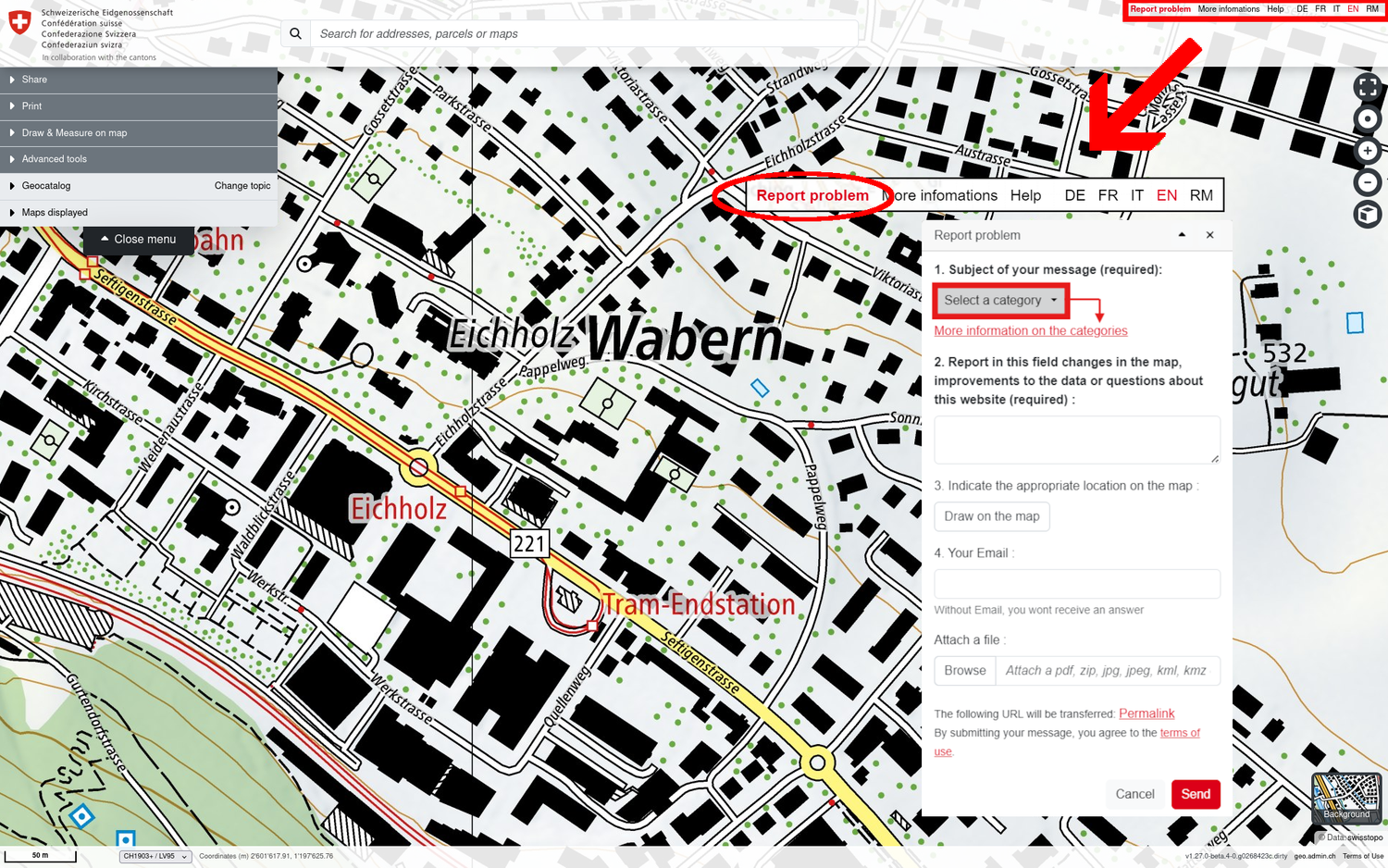
The first change has just been introduced, with the following simple categorisation. The message concerns:
- A revision of the background map
Use this category to enter errors, revision requests or feedback that you have observed on the background maps (Swiss national map series or aerial photograph background), for example: a place or area name on the map is incorrect; a bridge, building, path or other landscape feature is missing or is obsolete. This reporting category is typically used to collect so-called revision requests for the background maps. - A thematic map layer
Please enter your questions / reports here regarding the geodata layers that can be placed on the background maps and combined with each other from the catalogue in the left-hand menu or from the data search in map.geo.admin.ch. This category should be selected if, for example, you have a specific question regarding the "public transport stops" dataset or another subject in map.geo.admin.ch. - An application or a service
Have you found a functional error or a problem with the use of the web application map.geo.admin.ch or the services of geo.admin.ch? Do you have any operational or technical questions about map.geo.admin.ch, api3.geo.admin.ch, wm(t)s.geo.admin.ch or data.geo.admin.ch that are not answered by the help content or service documentation at geo.admin.ch? - Other
This category is intended for all concerns that cannot be assigned to the above three reporting categories.
Coordination, Geo-Information and Services (COGIS)
Federal Office of Topography swisstopo
Seftigenstrasse 264
Switzerland - 3084 Wabern
Seftigenstrasse 264
Switzerland - 3084 Wabern