
The federal geoportal records new highs. Reaching the Moon with geodata?
Federal government's mapviewer sets records once again
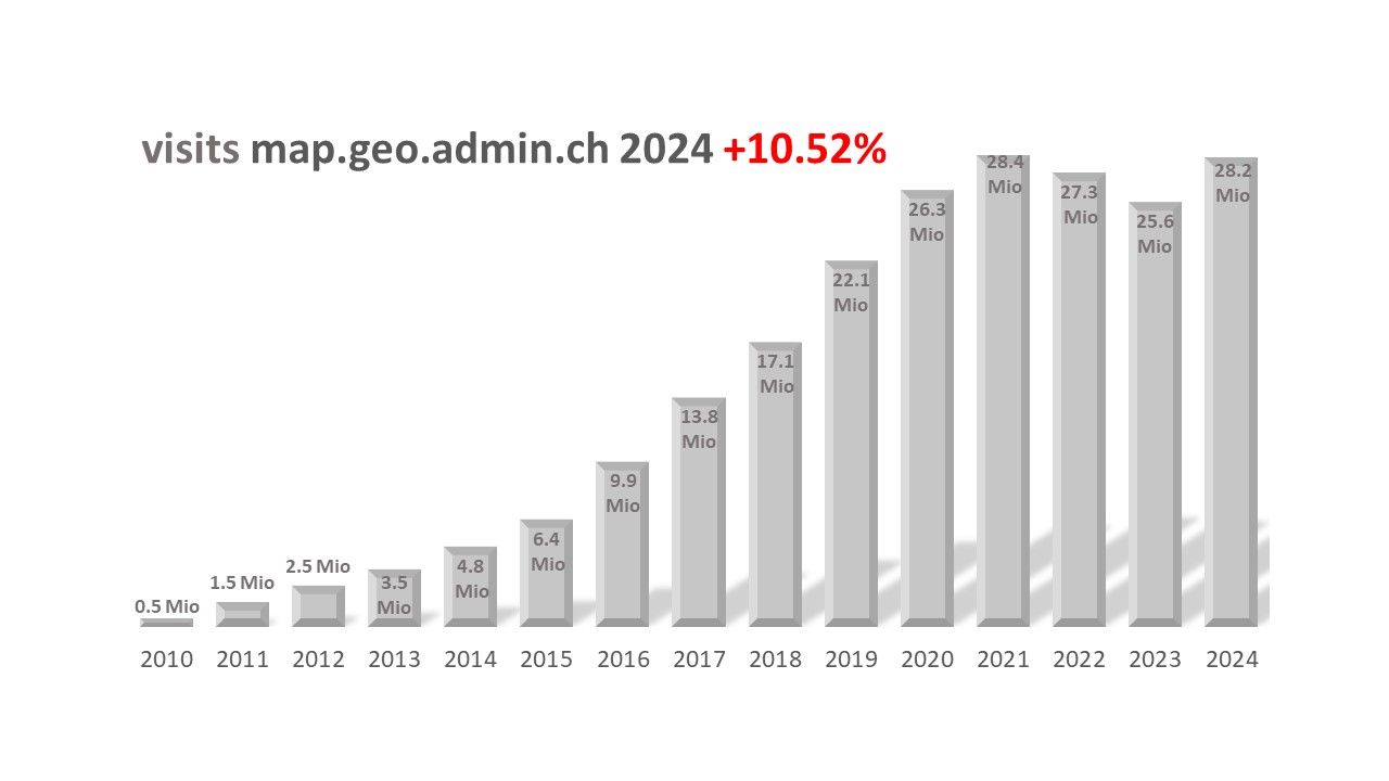
Since the geodata of the federal government was made publicly available on map.geo.admin.ch in 2010, the number of the platform's users has increased remarkably. In recent years, it has remained at a very high level. The 20 million visits mark was exceeded for the sixth time in a row. Only in 2024 more than 28 million visits were recorded on the map viewer of the federal geoportal. This clearly shows that this platform is one of Switzerland's most important digital resources. Engineers, architects, programmers and planners, as well as hikers and ski tourers can easily access official digital geodata.
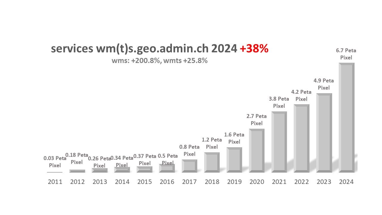
There are two main reasons for this success. Firstly, the continuous development of the offering and, secondly, the increasing popularity among external service providers. They benefit from the Open Government Data (OGD) and appreciate the reliability of the geoservices. In 2024, almost all geoservices were 100% operational.
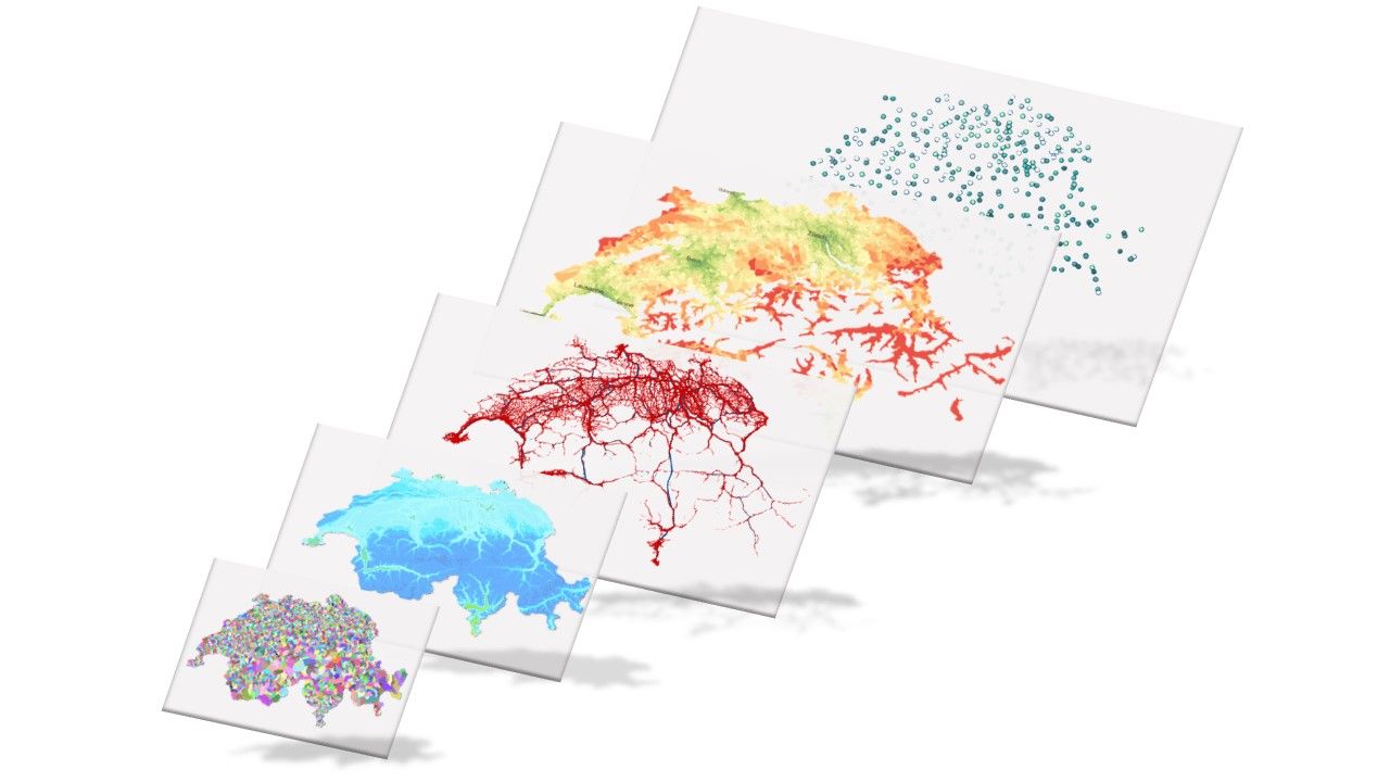
Centralized access to over 900 datasets
In partnership with the federal offices, the geoportal steadily broadens the variety of available datasets. For example, the newly added information on accommodation in winter, together with the cable cars/ski lifts and snow depth dataset, help winter outdoor fans to plan their leisure activities optimally. On the other hand, solar radiation and charging requirements for plug-in vehicles provide valuable information for infrastructure projects, just as groundwater heat utilisation potential and thermal waters meet the need for environmentally friendly solutions. Another interesting example is the dataset of emergency meeting points, which has generated great interest among the media and the public.
These are just a few examples of a total of 58 datasets from 23 federal offices that were published in 2024.
The amount of data grows continuously. Almost twice as many new datasets have been added compared to 2023. The *geo.admin.ch now includes 923 geodata sets.
The easiest way to innovative applications
Most geodata can be downloaded directly from the internet or accessed online via geoservices. Each dataset is provided in its latest version.
Since March 2021, when official data and products became freely available online under the Open Government Data initiative, usage has grown rapidly and consistently. Third-party providers have the option of easily integrating federal geodata into their own specialists and thematic applications via geoservices such as view services WM(T)S or data download services. Private companies and public authorities benefit from the geoportal's innovative infrastructure and can develop their own digital solutions without having to invest large sums of money.
The requirements of a mobile society can thus be met by numerous apps. Besides the swisstopo app, which now has 3 million users, several other well-known and widely used apps are available on the market. Apps from MeteoSwiss, Swiss Mobile and the Swiss Alpine Club SAC, which source geodata and geoservices from *geo.admin.ch, have become indispensable in daily life.
What amount of geodata is needed to reach the Moon?
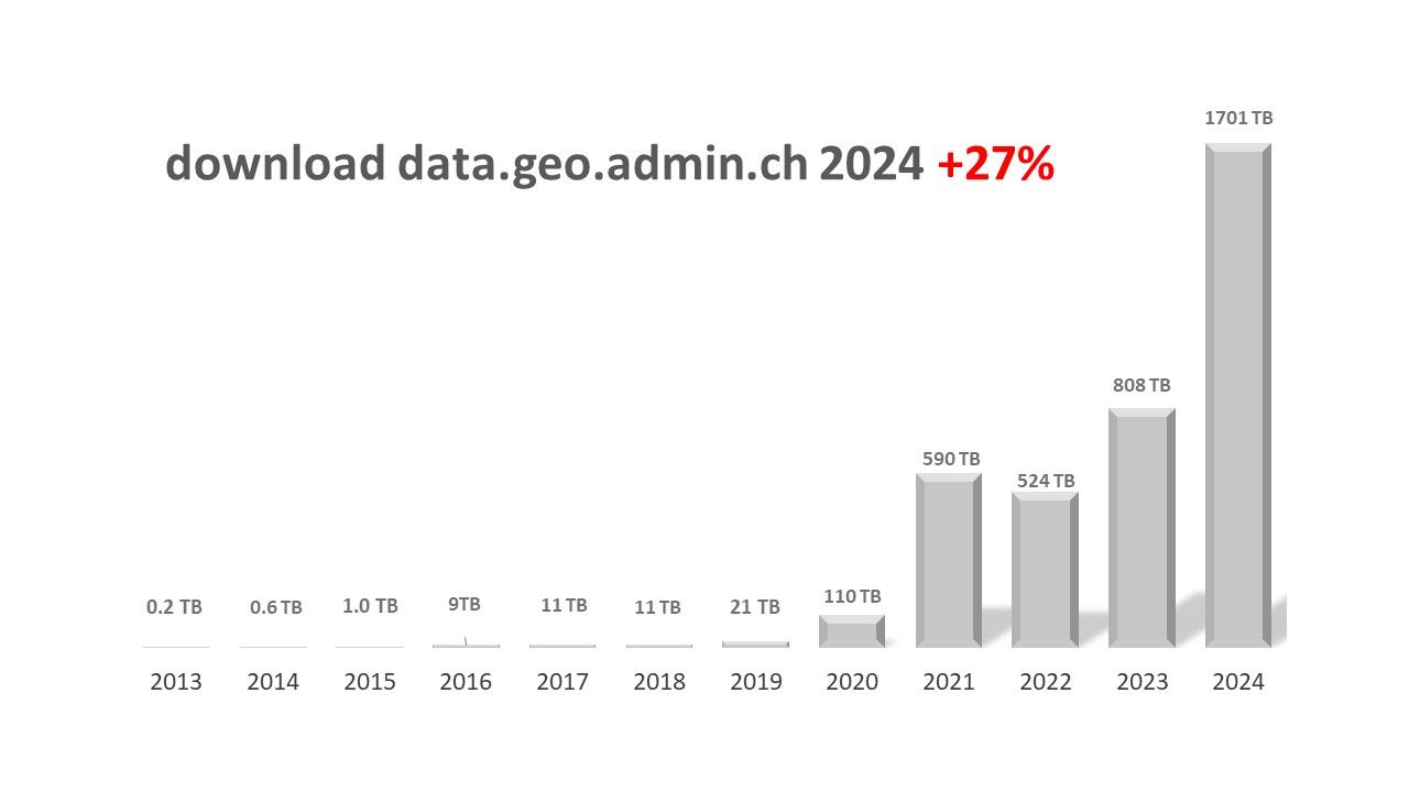
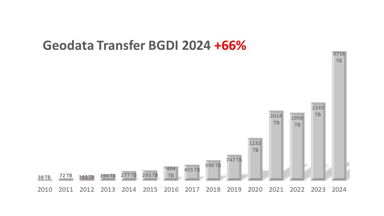
Altogether, the geodata retrieved through geoservices in 2024 corresponds to a volume of 3716 TB.
How much is that?
1 TB is equivalent to 20 million A4 pages1. If users had printed all the data used, the result would have been almost 74.3 billion pages. Laid out end to end, they would cover a distance of 22 million kilometres – 57 times further than to the moon!
1) A standard page of text in A4 format equals 50 KB. The average distance between the Earth and the Moon is approximately 384,400 km.