

25 years of geoinformation coordination: on the way to a common platform
For 25 years the coordinating agency for Federal geographical information, GCG has ensured connected, standardised and easily accessible geodata. What began in 2000 as an interdepartmental coordination group has now become the backbone of Switzerland’s national geodata infrastructure.
From basics to close cooperation
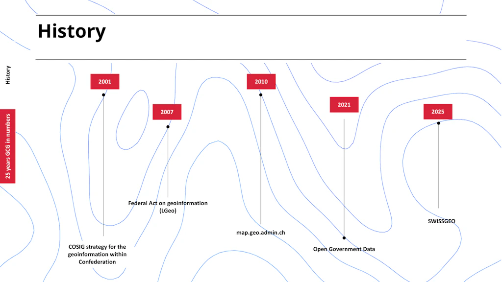
The goal was clear from the start: connect geodata across the country and establish standards. With the adoption of the Federal Geoinformation Strategy in 2001, the objectives were gradually achieved – from harmonisation to digitalisation, from legal frameworks to the promotion of education.
In 2007 Switzerland was among the first countries to adopt a Federal Act on Geoinformation (GeoIA), creating an ambitious legal framework that sustainably strengthened harmonisation and access to geodata.
Geodata at the service of Switzerland
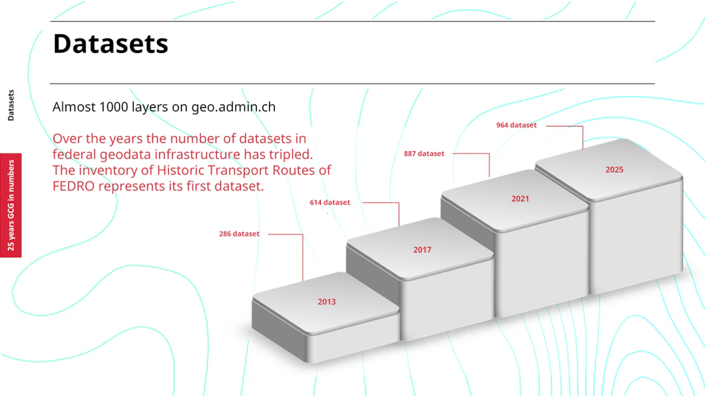
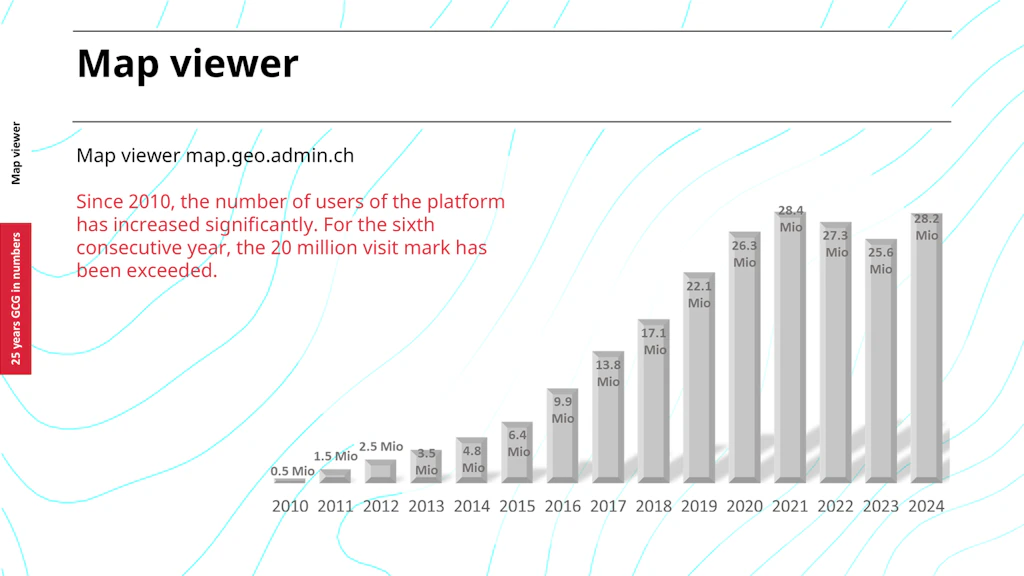
Launched in 2010, the geoportal map.geo.admin.ch provides access to the federal basic geodata. Today it is one of the most widely recognised online government services in Switzerland. With nearly 1,000 available topics – from environment, energy and infrastructure to security and spatial planning – the portal has become an indispensable digital resource for administration, business, science, and the general public.
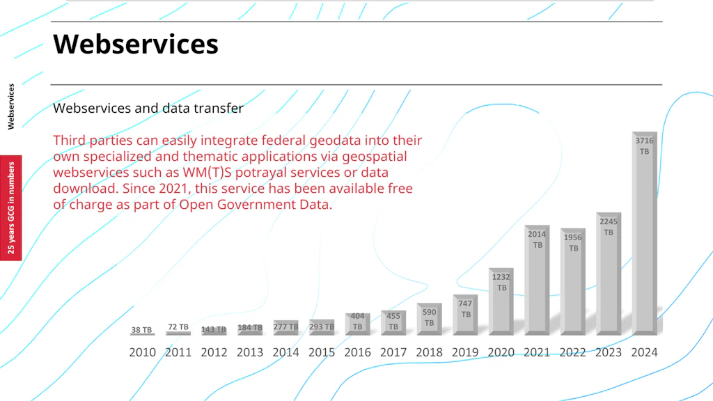
Another milestone came in 2021, when all standard digital products of the Federal Office of Topography swisstopo were made available free of charge as Open Government Data (OGD). This marked the beginning of a record era of data transfer. Numerous mobile apps such as Alertswiss, the swisstopo app or SwitzerlandMobility integrate plattform's information and make it directly accessible to the public.
25 years of history – looking to the future
This anniversary is not only a look back, but also a promise.
After 25 years, the story continues. “In cooperation with the cantons” has been the guiding principle of the coordination office from the very beginning. This vision is now being fully realised.
On the occasion of its anniversary, the coordination agency announces the launch of a new platform: SWISSGEO. In future, the Confederation together with the cantons will make their geoinformation and geodata available in one place, making it much easier for users to find the information they need.
SWISSGEO is a new flagship for geoinformation in Switzerland. The platform will be developed step by step in several phases. An initial prototype is already available online – the perfect opportunity to get a first impression.
Swisstopo press release (German): Ein einziges Geoportal für die Geodaten der Schweiz